Use xrefcoord to Generate Coordinates
When using Kerchunk to generate reference datasets for GeoTIFF’s, only the dimensions are preserved. xrefcoord is a small utility that allows us to generate coordinates for these reference datasets using the geospatial metadata. Similar to other accessor add-on libraries for Xarray such as rioxarray and xwrf, xrefcord provides an accessor for an Xarray dataset. Importing xrefcoord allows us to use the .xref accessor to access additional methods.
In this tutorial we will use the generate_coords method to build coordinates for the Xarray dataset. xrefcoord is very experimental and makes assumptions about the underlying data, such as each variable shares the same dimensions etc. Use with caution!
Overview
Within this notebook, we will cover:
How to load a Kerchunk reference dataset created from a collection of GeoTIFFs
How to use
xrefcoordto generate coordinates from a GeoTIFF reference dataset
Prerequisites
| Concepts | Importance | Notes |
|---|---|---|
| Kerchunk Basics | Required | Core |
| Xarray Tutorial | Required | Core |
Time to learn: 45 minutes
import xarray as xr
import xrefcoord  # noqa

storage_options = {
    "remote_protocol": "s3",
    "skip_instance_cache": True,
    "remote_options": {"anon": True}
}  # options passed to fsspec
open_dataset_options = {"chunks": {}}  # opens passed to xarray

ds = xr.open_dataset(
    "references/RADAR.json",
    engine="kerchunk",
    storage_options=storage_options,
    open_dataset_options=open_dataset_options,
)
# Generate coordinates from reference dataset
ref_ds = ds.xref.generate_coords(time_dim_name="time", x_dim_name="X", y_dim_name="Y")
# Rename to rain accumulation in 24 hour period
ref_ds = ref_ds.rename({"0": "rr24h"})Create a Map
Here we are using Xarray to select a single time slice and create a map of 24 hour accumulated rainfall.
ref_ds["rr24h"].where(ref_ds.rr24h < 60000).isel(time=0).plot(robust=True)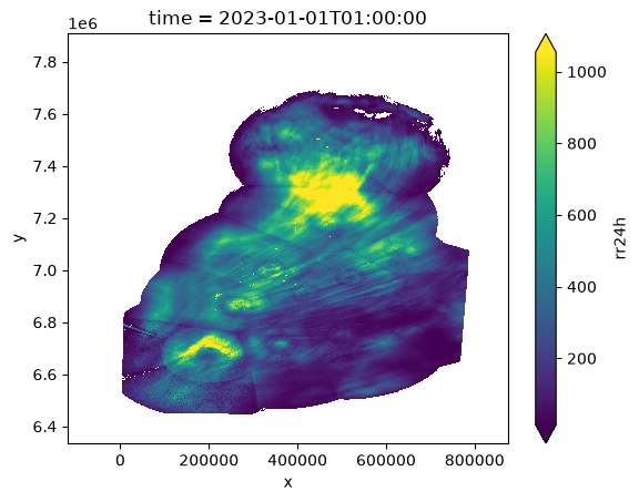
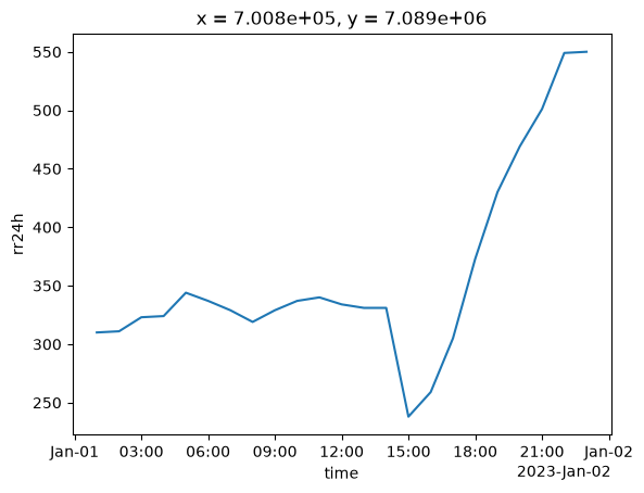
Create a Time-Series
Next we are plotting accumulated rain as a function of time for a specific point.
ref_ds["rr24h"][:, 700, 700].plot()